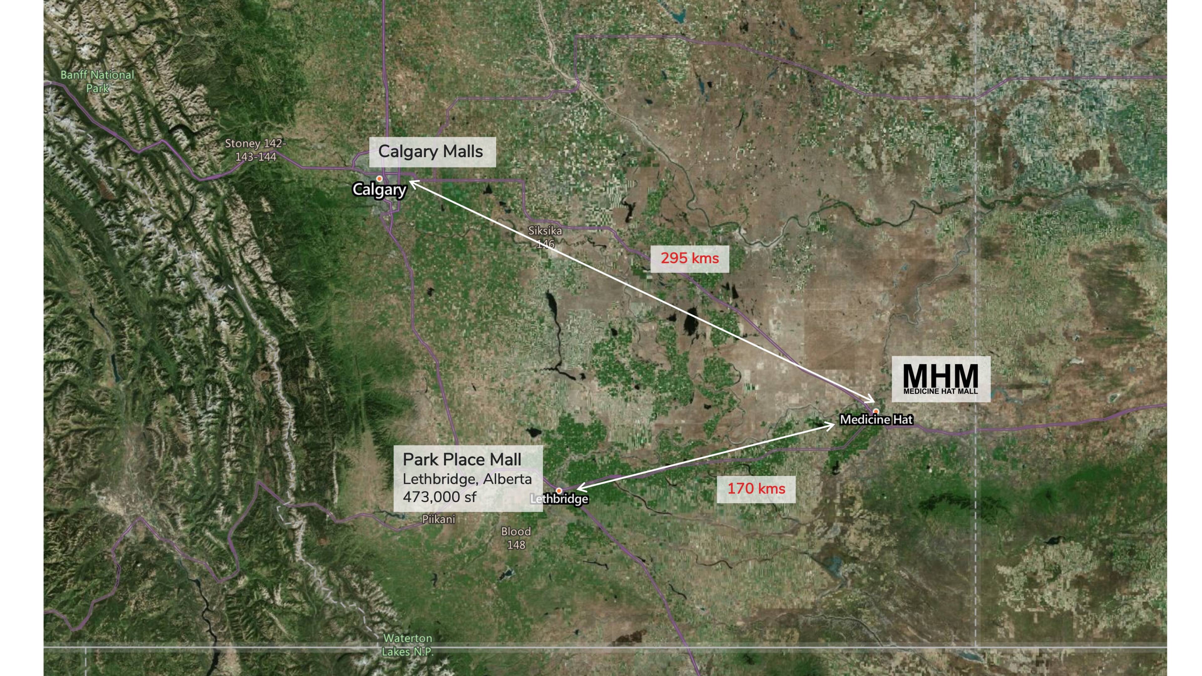
Medicine Hat is a city in southeast Alberta, Canada. It is located along the South Saskatchewan River. It is approximately 170 km east of Lethbridge and 295 km southeast of Calgary.
Our
market
Our market
Finlay Bridge spans 274 meters across the South Saskatchewan River, connecting Medicine Hat's north side to south.
Location
- The name "Medicine Hat" is an English interpretation of Saamis (SA-MUS) – the Blackfoot word for the eagle tail feather headdress worn by medicine men.
- Started as a railway town, today Medicine Hat is served by the Trans-Canada Highway and the eastern terminus of the Crowsnest. Nearby communities considered part of the Medicine Hat area include the Town of Redcliff and the hamlets of Desert Blume, Dunmore, Irvine, Seven Persons, and Veinerville. The Cypress Hills (including Cypress Hills Interprovincial Park) is a relatively short distance (by car) to the southeast of the city.
- As Medicine Hat receives less precipitation annually than most other cities on the Canadian Prairies and plentiful sunshine (it is widely known as "The sunniest city in Canada")

Watch video
Live here, Work Anywhere.
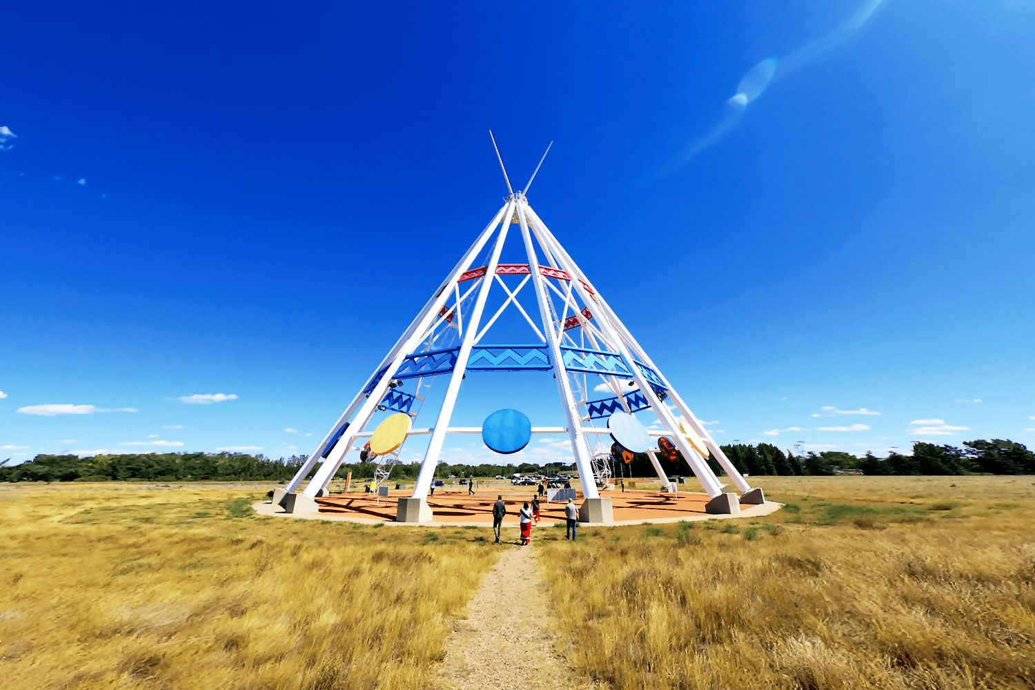
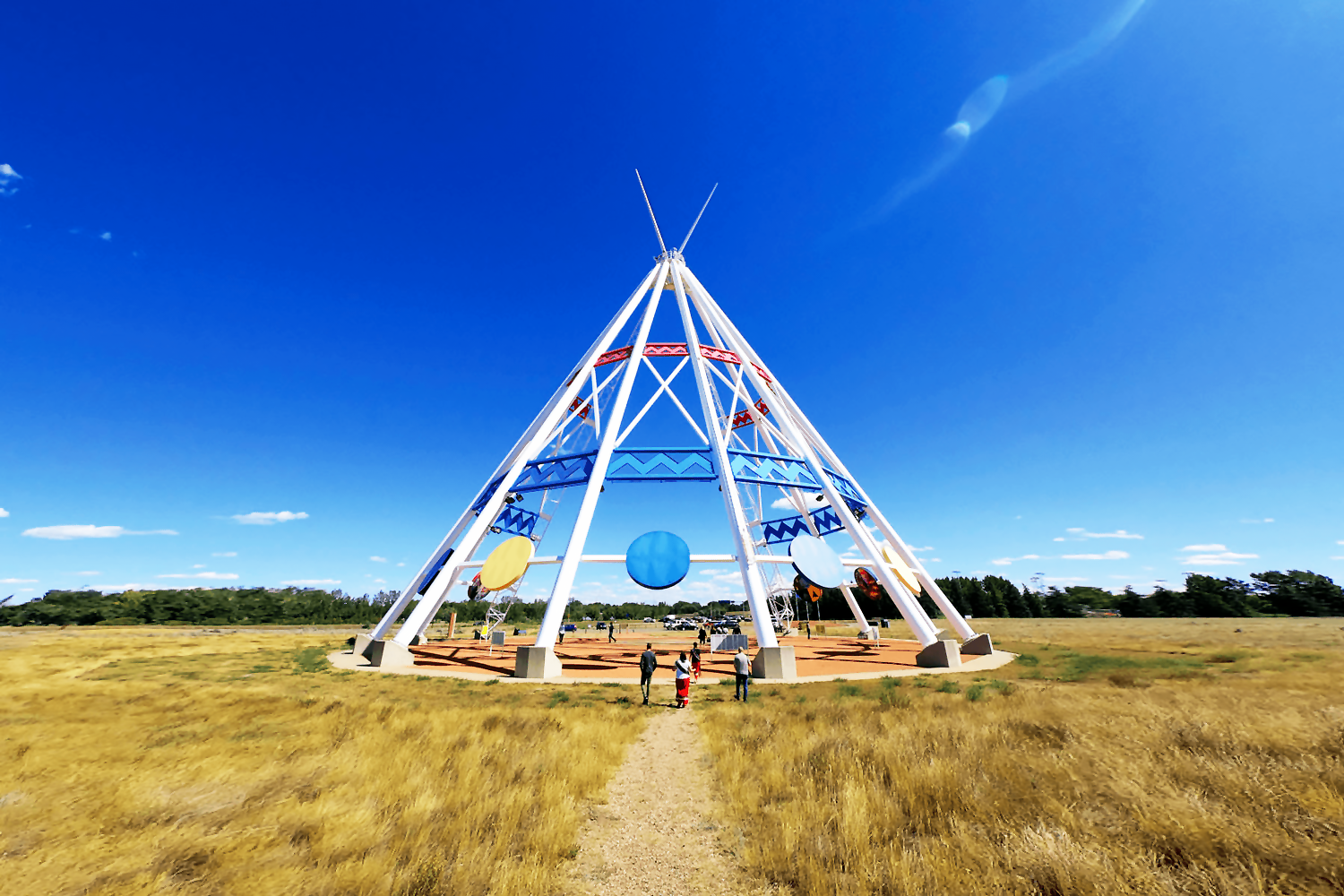
The Saamis Teepee is a prominent landmark, the world's tallest teepee (65.5 metres), built in 1988- Winter Olympics, Calgary.
Our market
Economic drivers
- Medicine Hat’s location provides businesses with the ability to reach major North American markets in a single day’s drive. The city is conveniently situated on the Trans-Canada Highway providing primary access to Calgary and Vancouver. With easy to access major highways, the railway, the airport, and the United States border, Medicine Hat is an ideal location for business and pleasure.
- The City of Medicine Hat owns and operates its own utilities including gas and electricity, providing amongst the most competitive tax and utility rates in all of Western Canada. Medicine Hat is a strategic location for military and defence
- Contractors, and companies operating in the fast-growing Unmanned Aerial Vehicle (UAV) sector. Medicine Hat-based aerospace and defence companies are strategically positioned between Canadian Forces Base Suffield, Defence and Research Development Canada, and Canada’s first Transport Canada-approved beyond-line-of-sight UAV range.
July 6, 2022 - The Southeast Alberta Hydrogen Task Force announced the release of its foundational report, Towards Hydrogen: A Hydrogen HUB Feasibility Study for Southeast Alberta, laying out the region’s strong potential for significant supply and demand, and a roadmap to implement hydrogen as a major fuel economy in Southeast Alberta.
Our market
Education
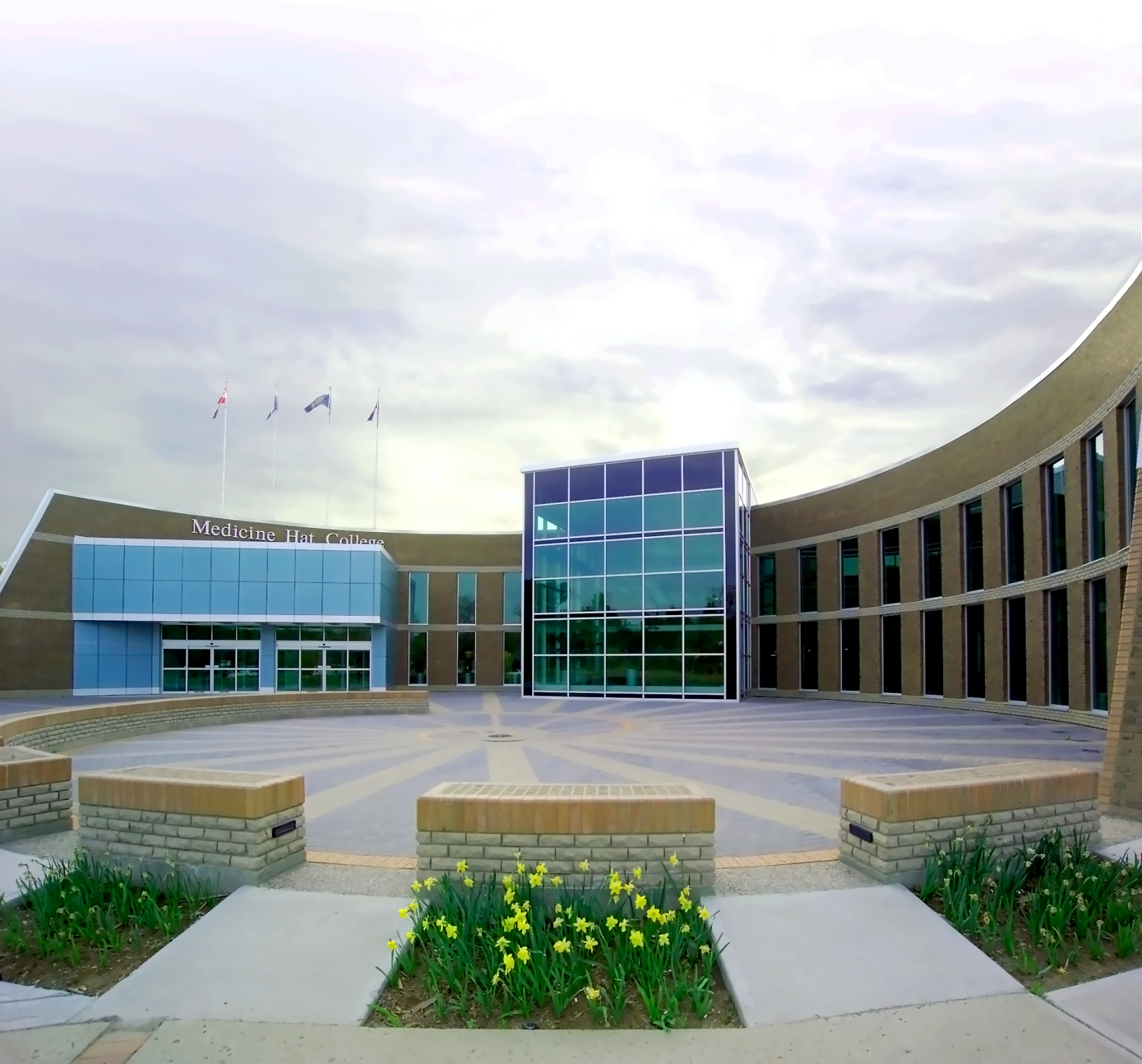
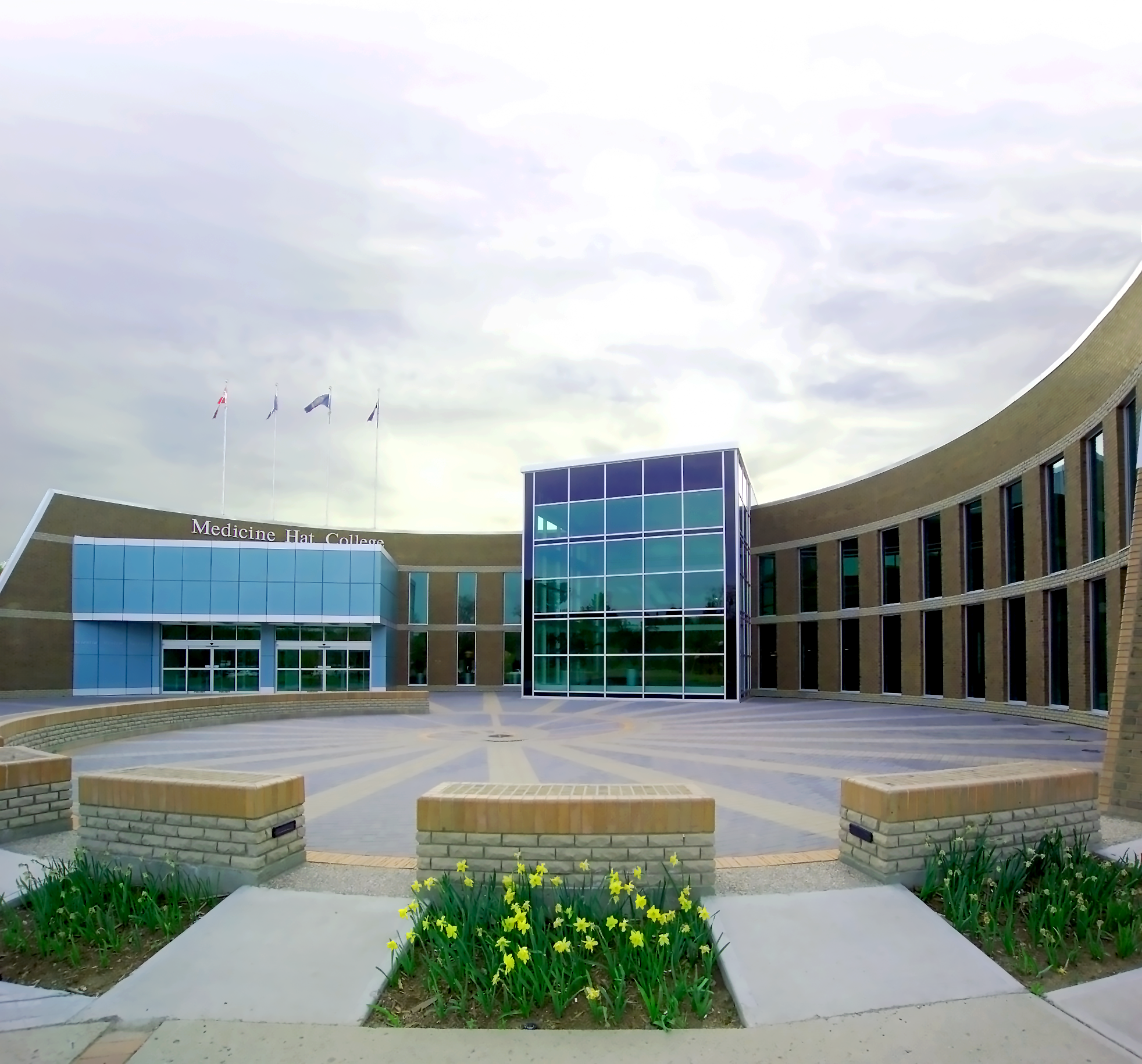
Medicine Hat College
Medicine Hat College
Medicine Hat College provides education that prepares students for further studies, careers and life. Our people are passionate about unleashing the potential of every student- intellectually, emotionally, and socially. Through every encounter we have with students- and all that we do- we will seek to recognize and encourage their potential as learners, workers and global citizens.
Our market
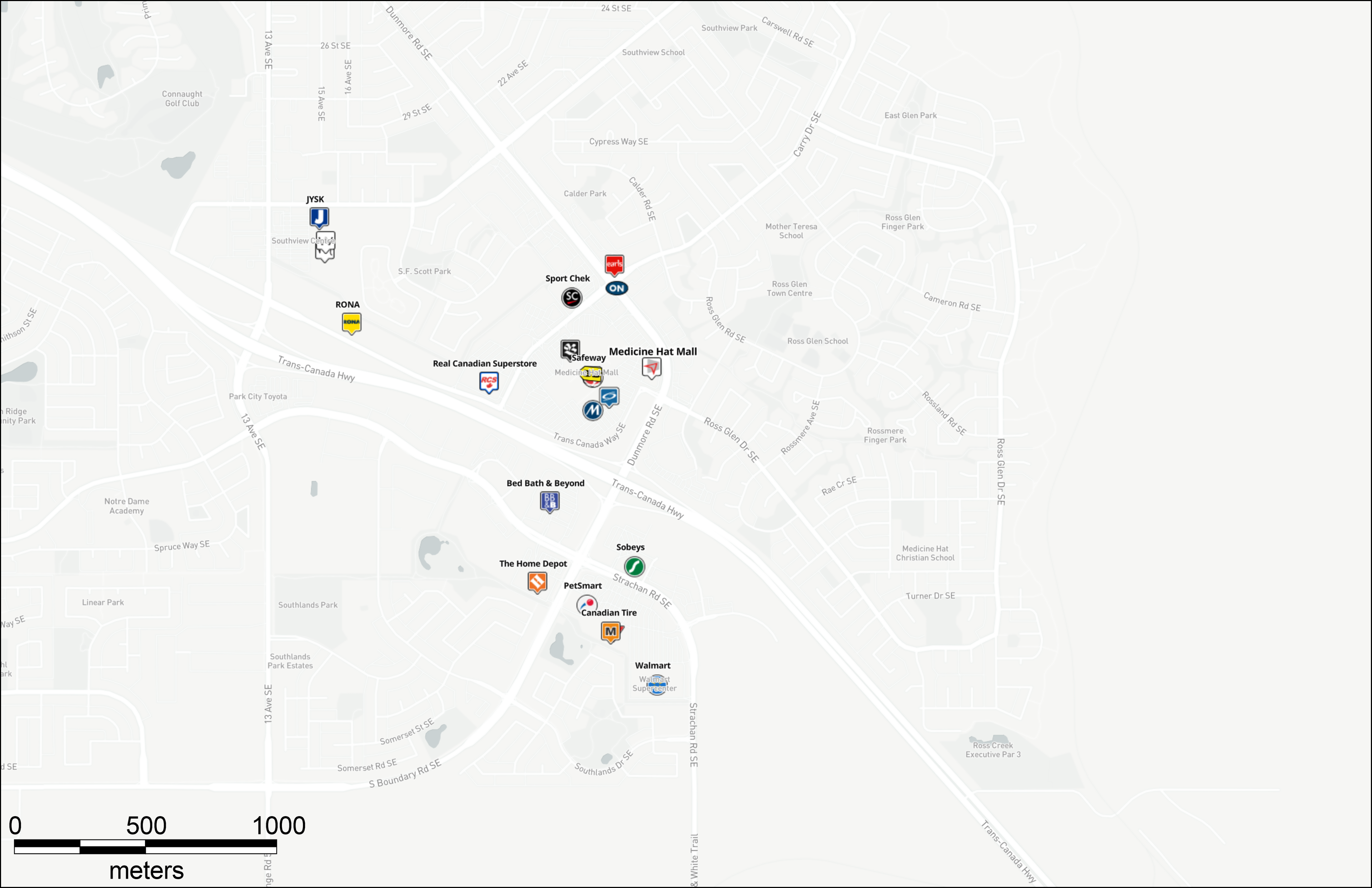
Local competition
Our market
Regional competition
Our
market
Medicine Hat is a city in southeast Alberta, Canada. It is located along the South Saskatchewan River. It is approximately 170 km east of Lethbridge and 295 km southeast of Calgary.
- The name "Medicine Hat" is an English interpretation of Saamis (SA-MUS) – the Blackfoot word for the eagle tail feather headdress worn by medicine men.
- Started as a railway town, today Medicine Hat is served by the Trans-Canada Highway and the eastern terminus of the Crowsnest. Nearby communities considered part of the Medicine Hat area include the Town of Redcliff and the hamlets of Desert Blume, Dunmore, Irvine, Seven Persons, and Veinerville. The Cypress Hills (including Cypress Hills Interprovincial Park) is a relatively short distance (by car) to the southeast of the city.
- As Medicine Hat receives less precipitation annually than most other cities on the Canadian Prairies and plentiful sunshine (it is widely known as "The sunniest city in Canada")
Our market
Location
Finlay Bridge spans 274 meters across the South Saskatchewan River, connecting Medicine Hat's north side to south.

The Saamis Teepee is a prominent landmark, the world's tallest teepee (65.5 metres), built in 1988- Winter Olympics, Calgary.
Our market
Economic drivers
Live here, Work Anywhere.
- Medicine Hat’s location provides businesses with the ability to reach major North American markets in a single day’s drive. The city is conveniently situated on the Trans-Canada Highway providing primary access to Calgary and Vancouver. With easy to access major highways, the railway, the airport, and the United States border, Medicine Hat is an ideal location for business and pleasure.
- The City of Medicine Hat owns and operates its own utilities including gas and electricity, providing amongst the most competitive tax and utility rates in all of Western Canada. Medicine Hat is a strategic location for military and defence
- Contractors, and companies operating in the fast-growing Unmanned Aerial Vehicle (UAV) sector. Medicine Hat-based aerospace and defence companies are strategically positioned between Canadian Forces Base Suffield, Defence and Research Development Canada, and Canada’s first Transport Canada-approved beyond-line-of-sight UAV range.
July 6, 2022 - The Southeast Alberta Hydrogen Task Force announced the release of its foundational report, Towards Hydrogen: A Hydrogen HUB Feasibility Study for Southeast Alberta, laying out the region’s strong potential for significant supply and demand, and a roadmap to implement hydrogen as a major fuel economy in Southeast Alberta.
Medicine Hat College
Our market
Education
Medicine Hat College
Medicine Hat College provides education that prepares students for further studies, careers and life. Our people are passionate about unleashing the potential of every student- intellectually, emotionally, and socially. Through every encounter we have with students- and all that we do- we will seek to recognize and encourage their potential as learners, workers and global citizens.
Our market
Local competition

Our market
Regional competition

